
Topographic Land Surveying in Trowbridge
Get in TouchAt MapCore Surveys, we specialise in providing topographic land surveying services in Trowbridge. Our surveys provide detailed and precise information on terrain features, elevations, and boundaries, essential for construction and development projects.
We use advanced technology to deliver comprehensive mapping and analysis, ensuring your project in Trowbridge and BA14 8 is grounded in accurate data. Contact us today for your topographic survey needs.
Book Topographic Land Surveying Today
What Is Topographic Land Surveying?
Topographic land surveying by MapCore Surveys involves detailed mapping of the natural and man-made features of the land in Trowbridge. Our surveys accurately depict the contours, elevations, and boundaries of a given area.
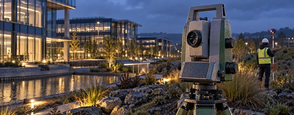
We use advanced equipment such as Global Navigation Satellite Systems (GNSS) and robotic Total Stations to capture precise measurements. This technology allows for high accuracy in data collection, making it essential for constructing reliable 3D models.
Survey data includes features like trees, buildings, roads, and utilities, ensuring that architects, engineers, and developers have a complete overview of the site. This information is crucial for designing projects that are well-aligned with the site's topology.
Our surveys typically comply with recognised standards such as the RICS Specification for Surveys of Land, Buildings and Utility Services, which guarantees consistency and accuracy. Our services provide the foundational data necessary for informed decision-making in project planning and execution.
How Much Does Topographic Land Surveying Cost in Trowbridge?
Topographic land surveying typically costs between £400 and £1,200 in Trowbridge, depending on the size and complexity of the site. Factors influencing the cost include the terrain's accessibility, the level of detail required, and any specific client requests.
For instance, if a site is located in a densely wooded area, more advanced equipment, like total stations or LiDAR technology, may be necessary to capture accurate data. Similarly, surveying sloped or uneven terrain often requires additional measurements and time, impacting the overall cost.
Clients seeking detailed 3D modelling or precise boundary delineations may also see increased fees to cover the added expertise and software implementation. Our team is proficient in using GPS systems and drones to increase efficiency and accuracy, adapting our methods to each unique project.
For a precise quotation, please contact our team for a tailored assessment.
Why Choose MapCore Surveys for Topographic Land Surveying in Trowbridge?
Choosing MapCore Surveys for your topographic land surveying needs in Trowbridge means benefiting from our expertise and commitment to accuracy. We employ cutting-edge technology, such as GPS-GNSS systems and robotic total stations, to ensure precise data collection and analysis.
Our team is skilled in interpreting complex terrain features, such as contours and elevations, to assist you in planning and executing your projects effectively.
We offer services for a wide range of projects, from residential and commercial developments to infrastructure growth like roads and bridges. Our surveys comply with the industry standard, TS 2.0, ensuring high precision.
We also provide detailed topographic maps and digital terrain models (DTMs) to visualise the project's landscape clearly.
Partnering with us means getting reliable service to support your success in every phase of development. Contact us today to discuss your specific requirements.
Speak to a Topographic Land Surveying Expert
What Are the Benefits of Topographic Land Surveying in Trowbridge?
Topographic land surveying offers several benefits in Trowbridge by providing detailed insights into the physical features and contours of a site:
Accurate Planning: We use theodolites and GPS equipment to generate precise data that aids in designing structures, ensuring they fit perfectly with the terrain. Our surveys include elevation profiles and slope analysis, which are crucial for architects and engineers.
Cost Efficiency: Early identification of potential site issues, such as drainage problems or unsuitable soil conditions, allows developers to address these before construction, reducing unexpected costs. Our surveys can identify utilities' locations, helping to avoid costly damage.
Regulatory Compliance: Our surveys assist in meeting planning and building regulations by supplying essential geospatial data. Adhering to standards like the RICS Code of Measuring Practice, we ensure that all necessary contours and elevations are documented.
Enhanced Safety: Detailed surveys support safer site management by identifying potential hazards such as unstable ground or hidden underground utilities, helping project teams implement appropriate safety measures.
Enlist our services for a survey that facilitates a project development process.
Frequently Asked Questions
How do you handle difficult terrain in topographic surveying?
We use equipment like Total Stations and drones to navigate and accurately map challenging terrains in Trowbridge. This allows us to provide precise data regardless of the site's complexity.
What technology does MapCore Surveys use for topographic land surveying?
MapCore Surveys employs GPS and Total Station technology to deliver accurate and detailed surveys in Trowbridge. We also use aerial drones where suitable.
Can MapCore Surveys provide surveys for urban areas in BA14 8?
Yes, we provide topographic surveys for both urban and rural areas in and around BA14 8. Our team adapts to various environments to deliver precise results.
How long does a topographic land survey take?
The duration of a topographic land survey can range from one to three days, depending on the size and complexity of the site surveyed. We strive for efficiency while maintaining accuracy.
Get a Free Quote for Topographic Land Surveying in Trowbridge
For professional topographic land surveying in Trowbridge, reach out to MapCore Surveys.
We cover Trowbridge (Wiltshire)