
Laser Surveying & 3D Scanning in Ryton
Get in TouchAt MapCore Surveys, we provide comprehensive laser surveying and 3D scanning services in Ryton, covering both urban and rural projects. Our precision techniques, including LiDAR and photogrammetry, deliver accurate topographic data and digital modelling to assist in land development, construction, and infrastructure planning.
Trust our expertise to cover the Ryton and the surrounding NE40 3 postcode area with detailed and reliable survey data. Contact us today to discuss your project needs and gain insights into site specifics.
What Is Laser Surveying & 3D Scanning?
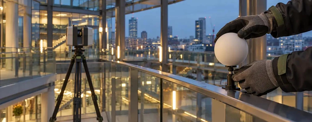
Laser surveying and 3D scanning involve using specialised equipment to capture precise measurements of a site or structure. At MapCore Surveys, we use technologies like LiDAR (Light Detection and Ranging) and terrestrial laser scanners in Ryton to create accurate digital representations.
These instruments can measure distances with millimetre accuracy, ensuring detailed and reliable data collection. Our services are invaluable for various applications, including construction planning, architectural design, and renovation projects, by providing comprehensive 3D models and point clouds.
These models include precise details such as surface topography, material dimensions, and layout features critical for engineers and architects.
Additionally, integrating Building Information Modelling (BIM) systems with our 3D scanning data allows for efficient project management and enhanced collaboration among stakeholders. This data helps clients make informed decisions, minimising errors and ensuring successful project outcomes.
Contact us to find out how we can support your project.
Book Laser Surveying & 3D Scanning Today
How Much Does Laser Surveying & 3D Scanning Cost in Ryton?
Laser surveying and 3D scanning costs typically range from £500 to £2,000 per site in Ryton. Factors influencing the price include the size and complexity of the site, the level of detail required, and specific project requirements.
A straightforward land survey may be on the lower end, whereas a detailed scan of a historical building would necessitate a higher cost.
The type of equipment used also plays a crucial role: for example, LiDAR sensors can capture vast areas efficiently, while high-resolution 3D laser scanners provide intricate details ideal for architectural projects. The cost can vary depending on the need for georeferencing to align scans with global coordinates, which is crucial for construction and civil engineering projects.
Turnaround time is another factor; urgent projects may incur additional fees for expedited service. Contact us for a tailored quote that suits your needs.
What Types of Laser Surveying & 3D Scanning Are Available in Ryton?
At MapCore Surveys, we provide a variety of laser surveying and 3D scanning options in Ryton to cater to different project requirements:
LiDAR Surveys: Efficient for large areas, providing high-resolution topographic maps by measuring the distance with laser pulses. LiDAR is particularly useful for forestry, flood risk assessments, and urban planning, capturing data even in densely vegetated regions.
Terrestrial Laser Scanning: Ideal for capturing detailed structural data and creating 3D models. Using fixed scanner positions, it measures precise distances within construction, heritage conservation, and civil engineering projects, ensuring high accuracy for detailed analysis.
Photogrammetry: Uses aerial images to generate comprehensive land surveys and mapping. This method is effective for agriculture, environmental monitoring, and archaeological site surveys, delivering detailed visual representations from various altitudes.
Mobile Mapping: Collects spatial data while in motion, useful for road and transport infrastructure projects. Using cameras and LiDAR, it quickly generates detailed geospatial data along transportation routes, aiding in maintenance and urban development planning.
Each method is chosen based on the specific needs of your project, ensuring accurate and actionable insights. For more information or to schedule a consultation, contact us today.
Why Choose MapCore Surveys for Laser Surveying & 3D Scanning in Ryton?
MapCore Surveys stands out for our expertise and advanced equipment in Ryton. Our dedication to accuracy and reliability ensures we deliver precise survey data every time.
We employ cutting-edge technologies, such as LiDAR (Light Detection and Ranging) systems and high-resolution 3D scanners, to capture detailed measurements that meet industry standards like ISO 9001:2015. Our team, experienced in various sectors including construction, architecture, and engineering, is adept at handling everything from topographic mapping to structural analysis.
Our survey solutions incorporate photogrammetry, a method that uses photography for collecting measurements and models, thereby enhancing the clarity and depth of data. We use equipment like total stations and GNSS (Global Navigation Satellite System) for precise positioning and location data.
With our approach, we ensure projects are completed in a timely manner, typically within agreed deadlines.
Get in touch to see how our survey solutions can benefit your project.
Speak to a Laser Surveying & 3D Scanning Expert
Frequently Asked Questions
How do I prepare for a laser survey in Ryton?
Preparing for a laser survey involves clearing the site of unnecessary obstructions and communicating your project's specific needs. Contact our team for further guidance.
Is laser surveying suitable for indoor and outdoor projects?
Yes, laser surveying and 3D scanning are suitable for both indoor and outdoor environments, offering flexibility for various project types in Ryton.
How do you ensure the accuracy of survey data?
At MapCore Surveys, we ensure accuracy by using calibrated equipment and conducting thorough data checks as part of our quality assurance process.
What areas do you cover?
We service Ryton and the surrounding NE40 3 postcode area, providing surveying solutions for diverse client needs.
Get a Free Quote for Laser Surveying & 3D Scanning in Ryton
To discuss your surveying needs or to obtain a free quote, contact us today.
We cover Ryton (Tyne and Wear)